Hiking Guide, Hot Springs Canyon Trail -Montecito, Santa Barbara. Directions, Maps, Parking
Hiking Guide, Hot Springs Canyon Trail -Montecito, Santa Barbara County. Directions, Maps, Parking. This hike is about 100 Miles from Los Angeles and about 2 hours to get there from Los Angeles
Let’s Connect:
SUBSCRIBE
Instagram: HikerOnATrail
To Hot Springs:
*3.2 Miles Roundtrip
*928 Feet Elevation Gain
*2 hrs & 30 minutes Roundtrip
***There are other trails this hike connects to, we only explored to the Hot Springs today***
*NO Parking Pass Needed, always read parking signs
*NO Bathrooms
*Park Hours -8am to Sunset, from what the sign says
*Dogs- I didn’t see a sign for ‘no dogs’ and I DID see a dog at the Hot Springs
DIRECTIONS:
On Your Smart Phone: Hot Springs Canyon Trailhead
Trailhead Coordinates: 34.44919,-119.64565
City: Montecito, California. Santa Barbara County
Cross Streets: E. Mountain Dr. & Riven Rock Rd.
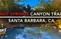
-Yes, the water is that blue, and no I didn’t use any filters on my video
-Yes the water is super hot, i had to step out after a few minutes when i was in the top one
Check out Hiking Guide Santa Paula Punchbowls https://www.youtube.com/watch?v=TgVS4GstPkI
Timeline
00:00 Intro
00:30 Parking
01:05 Map
01:33 Directions to Hot Springs
04:16 Where to TURN
05:08 Ocean Views
05:25 HOT SPRINGS
